Siirt: Saints, Scholars and the Botan Canyons
On this page
- What is Siirt?
- How do you get to Siirt?
- Where should you stay in Siirt?
- What type of climate does Siirt have?
- When is the best time to visit Siirt?
- What is the history of Siirt?
- What is Siirt famous for?
- What are the historical places of Siirt?
- What are the best things to do in Siirt?
- What are the best places to visit in Siirt?
- What is the traditional food of Siirt?
- What should you buy in Siirt?
- Frequently asked questions about Siirt
- What do the official records say about Siirt?
Key facts: Siirt
- Region: The northeastern corner of Southeastern Anatolia, where the plains rise into the mountains; the whole province drains into the Tigris.
- Best known for: The tomb of the 18th-century scholar İbrahim Hakkı at Tillo, the shrine of Veysel Karani at Baykan, and the Seljuk-era tiled minaret of the Great Mosque.
- Nature: Botan Valley National Park, a canyon landscape declared a national park in 2019.
What is Siirt?
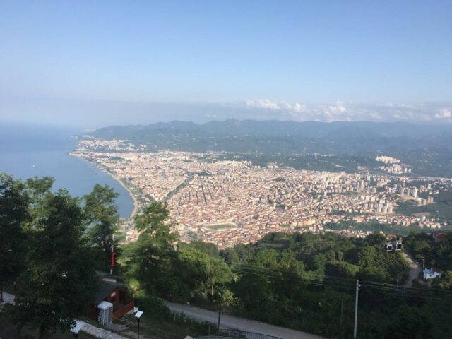
Siirt is a province in southeastern Türkiye, and the name of its capital. It lies where the flat plains of upper Mesopotamia end and the land rises suddenly into the mountains south of Muş and Bitlis. The 2002 provincial inventory explains that the province is bounded by Şırnak and Van to the east, Batman and Bitlis to the north, and Mardin and Şırnak to the south, and that all of its territory lies in the basin of the Tigris, Türkiye’s fourth-largest catchment after the Euphrates, Kızılırmak and Sakarya.
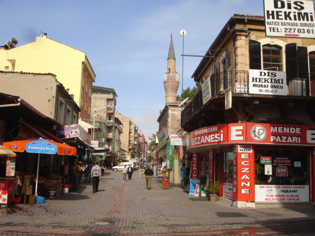
The province is small and little visited by foreign travellers, but it has a strong identity. The inventory describes it as a place worth seeing for its climate, in which the four seasons are lived in their finest form; for its blankets and kilims, woven by hand; for Pervari honey, its large-grained pistachios and the Zivzik pomegranate; and for its natural beauty, historic monuments and the saints it shelters.
Most visitors come for its places of pilgrimage: the tomb of İbrahim Hakkı and his teacher İsmail Fakirullah at Tillo, and the shrine of Veysel Karani at Baykan. Since 2019 the deep canyons of the Botan River have been a national park, with walking trails and a paragliding launch a short drive from the city.
Places to visit in Siirt
Great Mosque of Siirt
Great Mosque of Siirt (Ulu Cami): the Seljuk-era mosque repaired in 1129,…
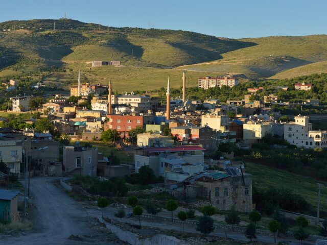
Tillo
Tillo (Aydınlar) near Siirt: the tomb of İbrahim Hakkı and İsmail Fakirullah,…
Veysel Karani Shrine
Veysel Karani Shrine at Baykan, Siirt: the tomb and mosque of Uwais…
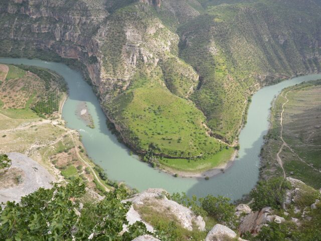
Botan Valley National Park
Botan Valley National Park near Siirt: the canyons of the Botan River,…
How do you get to Siirt?
By air: Siirt Airport (SXZ) has Turkish Airlines flights from Istanbul Airport and AJet flights from Ankara. Batman Airport, with flights from Istanbul and Ankara, and the larger Diyarbakır Airport are alternatives.
By road: Intercity coaches run to Siirt from Istanbul, Ankara and the cities of the southeast. Minibuses connect Siirt with Batman, Kurtalan, Baykan and the province’s districts.
By rail: The railway from Ankara through Diyarbakır and Batman ends at Kurtalan, in Siirt province, served by an overnight train. The inventory notes that the line reached Kurtalan in 1944, the first link that opened the province to the national market.
Where should you stay in Siirt?
Siirt city has a small number of hotels, mostly modern and aimed at business and official travellers. It is the practical base for Tillo, which is only about 7 km away, and for the Botan Valley. If you are touring the region by car, Batman and Diyarbakır have a wider choice, and Baykan lies on the main road from Diyarbakır towards Bitlis.
Tours in Anatolia
−5% Istambul readers save 5% on every tour below — applied at checkout.
Partner listings via GetYourGuide · free cancellation on most
What type of climate does Siirt have?
The inventory describes a continental climate in which all four seasons show their most distinct character. Summers are very hot and dry; winters are chilly and wet, with frequent frost and occasional snow. The city gets around 700 mm of rain a year, and the inventory notes that the eastern and northern parts of the province receive heavy precipitation, so the high plateaus are covered with rich meadows in summer.
When is the best time to visit Siirt?
Spring and autumn. In April and May the hills are green and the valleys are at their best for walking. May is also the busiest month at the shrine of Veysel Karani, which the inventory says receives crowds of visitors from all over the country in spring, and events at İbrahim Hakkı’s tomb in Tillo run each year from 18 May to 22 June, the anniversaries of his birth and death. Late September and October bring cooler weather after the summer heat. July and August are hot in the city and the lower valleys, but this is the season for the high plateaus of Pervari and Şirvan.
What is the history of Siirt?
In late antiquity the town, then known as Saird, was the seat of a Christian diocese. In the Middle Ages the main city of the region was Arzen, whose ruins lie in today’s Kurtalan district, and it competed with Hasankeyf for control of the area. Siirt became a regional centre only in the 14th century, and it remained dependent on Hasankeyf until the 17th century.
Several of Siirt’s monuments date from this medieval period. The Great Mosque was repaired and enlarged in 1129 by the Seljuk ruler Mughith al-Din Mahmud, and the Asakir Mosque was built by the Artuqids in 1265. In the early 18th century the village of Tillo became a centre of learning around the Sufi master İsmail Fakirullah and his pupil İbrahim Hakkı of Erzurum, author of the Marifetname.
From 1858 to 1915 Siirt was the seat of a Chaldean Catholic bishop, and the inventory lists the ruins of many churches and monasteries across the province. The inventory records that Siirt was made an independent sanjak on 26 September 1919 and became a province in the early years of the Republic. Its remote position, far from the trade routes, kept its economy closed: until 1940, it says, Siirt had limited contact even with neighbouring provinces. The railway to Kurtalan in 1944 and the discovery of oil in the 1940s changed the province’s social and economic structure. In 1990 Batman, including Hasankeyf, was separated from Siirt to form a new province.
What is Siirt famous for?
Saints and scholars. İbrahim Hakkı’s tomb at Tillo and the shrine of Veysel Karani at Baykan are the province’s best-known places of visit.
Siirt blankets. The inventory names Siirt’s blankets and kilims, woven by hand, first among its products.
Pistachios, honey and pomegranates. The inventory singles out the large-grained Siirt pistachio, Pervari honey and the Zivzik pomegranate, each with its own flavour.
The tiled minaret. The minaret of the Great Mosque, decorated with turquoise glazed brick and tile, is the landmark of the city.
Büryan. Siirt is the home of büryan, lamb slow-cooked whole in a pit oven.
What are the historical places of Siirt?
In Siirt city
The Great Mosque (Ulu Cami). Its exact construction date is unknown. It was repaired in 1129 by the Seljuk ruler Mughith al-Din Mahmud and extended in 1260 by Atabeg al-Mujahid Ishaq. See our Great Mosque guide.
Asakir Mosque. The inventory dates it to 1265 under the Artuqids. Originally three domes side by side, it was extended with two more, creating a plan that develops widthways, as in all of Siirt’s mosques.
Cumhuriyet Mosque. Its date of construction is unknown. It was repaired in 1926, when its name was changed from Hıdr-ül Ahdar to Cumhuriyet (Republic) Mosque. A space with two domes was added to the east of the original single-domed building, and the carved wooden door that Sheikh Neccar had made for the mosque is kept in its store.
Tombs. The inventory lists the tomb of Sheikh Ebul Vefa at the entrance of the city, and the tomb of Sheikh Muhammed el-Hazin in Deryamaç village, 10 km from Siirt, both visited by local people.
Around the province
Tillo. The tomb of İsmail Fakirullah and İbrahim Hakkı, about 7 km from the city. See our Tillo guide.
Veysel Karani shrine. In Ziyaret village, Baykan district, on the Diyarbakır–Bitlis road. See our Veysel Karani guide.
Kiver Castle. South of Eruh on the slope of Kiver Mountain. According to legend it was built in the 13th century on the highest peak of the 1,750 m mountain. Besides wells cut into the rock to meet the need for water, there are storage chambers carved out of the rock, although the wells hold water even in summer. In the high rocks east of the castle are hollows carved like beehives, made so that bees could shelter and make honey; these remain as they were, but the rock-cut steps up to the castle have worn away.
Derzin Castle. On a very steep hill, with watchtowers that, the inventory says, have lost nothing of their original state. Because a rebel named Şahkulu is said to have taken refuge there in Ottoman times, it is also called Şakuli Bey Castle.
Kormas Castle. In Kerimes village, Şirvan district, thought to be Byzantine, though local tradition says it was built by the Hurum. It passed from the Byzantines to the Seljuks and became a residence of a beylerbeyi under the Ottomans; the inventory describes it as more of a château.
İrun Castle. On the summit of steep mountains 40 km north of Şirvan, linked by an underground tunnel to the river that flows at the foot of the mountain.
Bünyan Wall. On the bank of the Botan stream on the Pervari road, between Taşlı village in Şirvan and Taşbalta village in the central district: a solid wall that guides the river, with a road running over it.
Erzen ruins. The site of medieval Arzen covers a wide area between Bozhöyük and Gökdoğan villages in Kurtalan district.
Churches and monasteries. The inventory lists, among many ruined churches and monasteries, those in the villages of Asmadere, Tulumtaş and Beykent in Kurtalan; the Hosyar church on the Bitlis road in Baykan; the church in Hef village, Pervari; the Haderuis church in central Siirt; and the church in Ayrancı village, Beşiri. (Beşiri has since become part of Batman province.)
What are the best things to do in Siirt?
- Walk in the Botan Valley. Marked trails lead through the canyon; the Botan Summit trail climbs to a 1,180 m viewpoint.
- Paragliding over the canyon. The provincial directorate lists a paragliding launch site in the Botan Valley, about 15 minutes’ drive from the city; ask locally about tandem flights.
- Take the waters. The inventory describes the Billoris (Sağlarca) spring, 15 km from Siirt on the Eruh road on the bank of the Botan, with sulphurous water at 35°C used for skin and rheumatic complaints; the Hısta spring on the Tigris in Eruh district, at 60°C, said in legend to be a beauty spring given by Solomon to the Queen of Sheba; and the Lif spring near Kışlacık village, at 41°C.
- Go up to the plateaus. The inventory notes that the Çemikari, Cema and Herekol plateaus in Pervari and the Baçova plateau in Şirvan are popular with local people, high meadows where sports clubs hold summer camps.
- Watch karakucak wrestling. The inventory lists karakucak wrestling events in early summer, including in Taşmanlı village.
- Visit the caves. The inventory notes that limestone has produced many caves along the valleys, some with traces of human habitation, the best known being the Botan caves.
What are the best places to visit in Siirt?
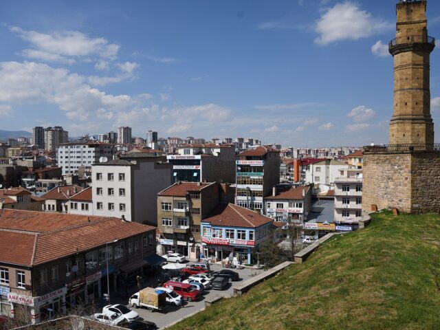
The Great Mosque of Siirt has a Seljuk-era minaret clad in turquoise glazed brick and tile, rebuilt in the 1970s after it began to lean.
Tillo is the hilltop town where İbrahim Hakkı of Erzurum studied and is buried, beside his teacher İsmail Fakirullah, in a domed tomb he designed himself.
The Veysel Karani shrine at Baykan is one of the best-known places in Anatolia associated with Uwais al-Qarani, visited by large crowds each spring.
Botan Valley National Park protects the deep canyons of the Botan River south of the city, with walking trails and a paragliding launch.
Also worth your time: Kiver Castle near Eruh, and, across the border in Batman province, Hasankeyf and Malabadi Bridge.
What is the traditional food of Siirt?
The signature dish is büryan: lamb lowered into a deep pit oven and slow-cooked until it falls off the bone, eaten in the morning with bread. Perde pilavı, a rice pilaf with chicken, almonds and currants baked in a pastry shell, is served at weddings. Look also for local honey from Pervari, Siirt pistachios and the Zivzik pomegranate, all named by the inventory.
What should you buy in Siirt?
Siirt blankets. Soft woven blankets, traditionally made from mohair, and kilims: the inventory calls them the product of handwork and care.
Pistachios and honey. Large-grained Siirt pistachios and Pervari honey are sold across the city.



Frequently asked questions about Siirt
What is Siirt famous for?
The tomb of İbrahim Hakkı and İsmail Fakirullah at Tillo, the Veysel Karani shrine at Baykan, the tiled minaret of the Great Mosque, Siirt blankets, pistachios and büryan.
What is the nearest airport to Siirt?
Siirt Airport (SXZ), with Turkish Airlines flights from Istanbul and AJet flights from Ankara. Batman and Diyarbakır airports are alternatives.
How far is Tillo from Siirt?
About 7 km, according to the provincial culture and tourism directorate. It is a short taxi or minibus ride.
When did Botan Valley become a national park?
It was declared a national park in the Official Gazette on 15 August 2019. It lies in the central, Tillo and Eruh districts of Siirt.
What is büryan?
Siirt’s best-known dish: lamb slow-cooked in a deep pit oven until very tender, usually eaten in the morning with bread.
When is the best time to visit Siirt?
April–May and late September–October. May is the busiest month at the Veysel Karani shrine, and summer is the season for the high plateaus.
What do the official records say about Siirt?
Siirt is a place worth seeing, with its climate in which the four seasons are lived in their most beautiful form, its blankets and kilims that are the product of handwork and devoted care, its healing Pervari honey, its large-grained pistachios, its Zivzik pomegranate with its own particular flavour, its natural beauty, its historic monuments and the saints it holds in its bosom. Hot springs, tombs, historic mosques, castles and bridges hold a very important place among Siirt’s historical and touristic assets.
The region rises suddenly after the plains of Southeastern Anatolia, and its eastern and northern parts receive abundant rainfall. For this reason the province, surrounded by the Southern Muş Mountains to the north and the Eastern Siirt Mountains to the east, forms one of the important catchment areas of the Tigris. (Ministry of Culture and Tourism, Siirt Provincial Tourism Inventory, 2002)
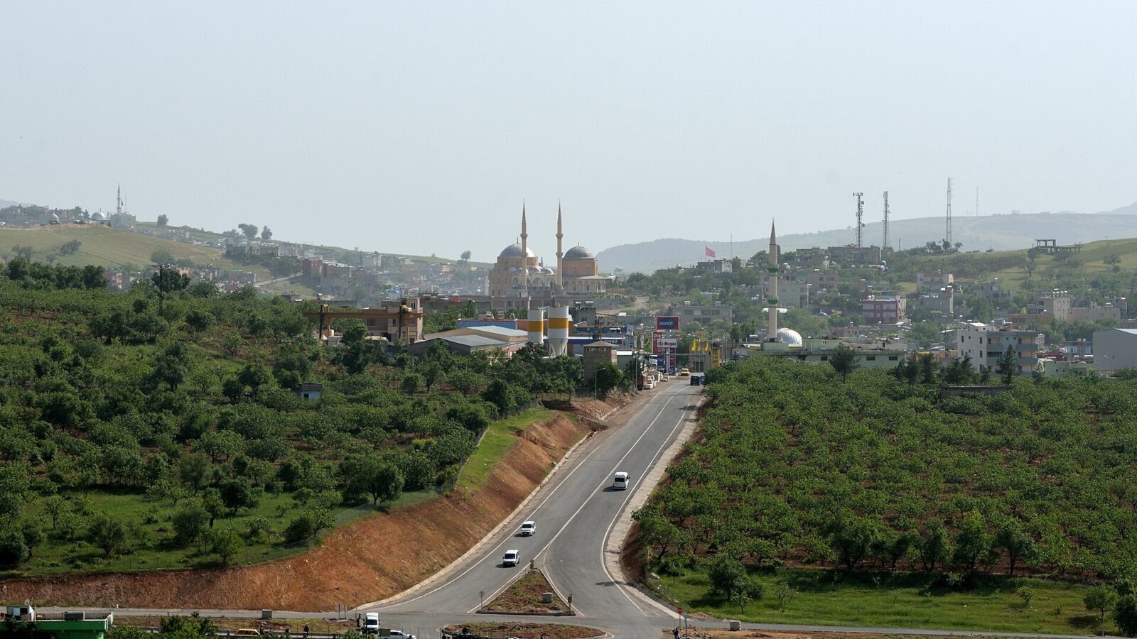
Main photo: Dûrzan Cîrano, CC BY-SA 4.0, via Wikimedia Commons.
Ready to see Siirt?
Hand-picked tours with good reviews and clear prices.
Partner listings via GetYourGuide · free cancellation on most
Before or after: Istanbul
Most trips start or end in Istanbul. Our own experiences there:
 Dinner, sunset and day cruises between Europe and Asia.See cruises bosporuscruise.com
 Historic Turkish baths in the old city — hand-picked hamams, booked direct.Book a hamam istanbulhamam.com
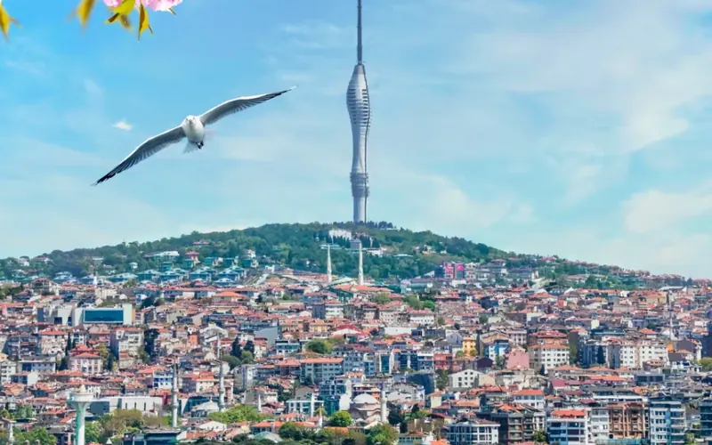
 Istanbul’s tallest viewpoint: both continents from 369 metres.Get tickets camlicatower.com
 Free audio guides in 15 languages, safe routes and local tips — plus 5% off GetYourGuide.Open the free guide localada.com