Ulubey Canyon: Glass Terrace over Uşak’s Gorges
On this page
- What is Ulubey Canyon?
- How do you get to Ulubey Canyon?
- When is the best time to visit Ulubey Canyon?
- What is the history of Ulubey Canyon?
- What is Ulubey Canyon famous for?
- What can you do at Ulubey Canyon?
- Frequently asked questions about Ulubey Canyon
- What do the official records say about Ulubey Canyon?
Key facts: Ulubey Canyon
- What it is: A branching canyon system cut by the Banaz and Kazancı streams, protected as a nature park since 2013.
- Where: Ulubey and Karahallı districts, Uşak; the park lies just north of Ulubey town, about 30 km southwest of Uşak city.
- Glass terrace: A 135 m² glass-floored viewing deck 131 m above the canyon floor, opened in 2015.
What is Ulubey Canyon?
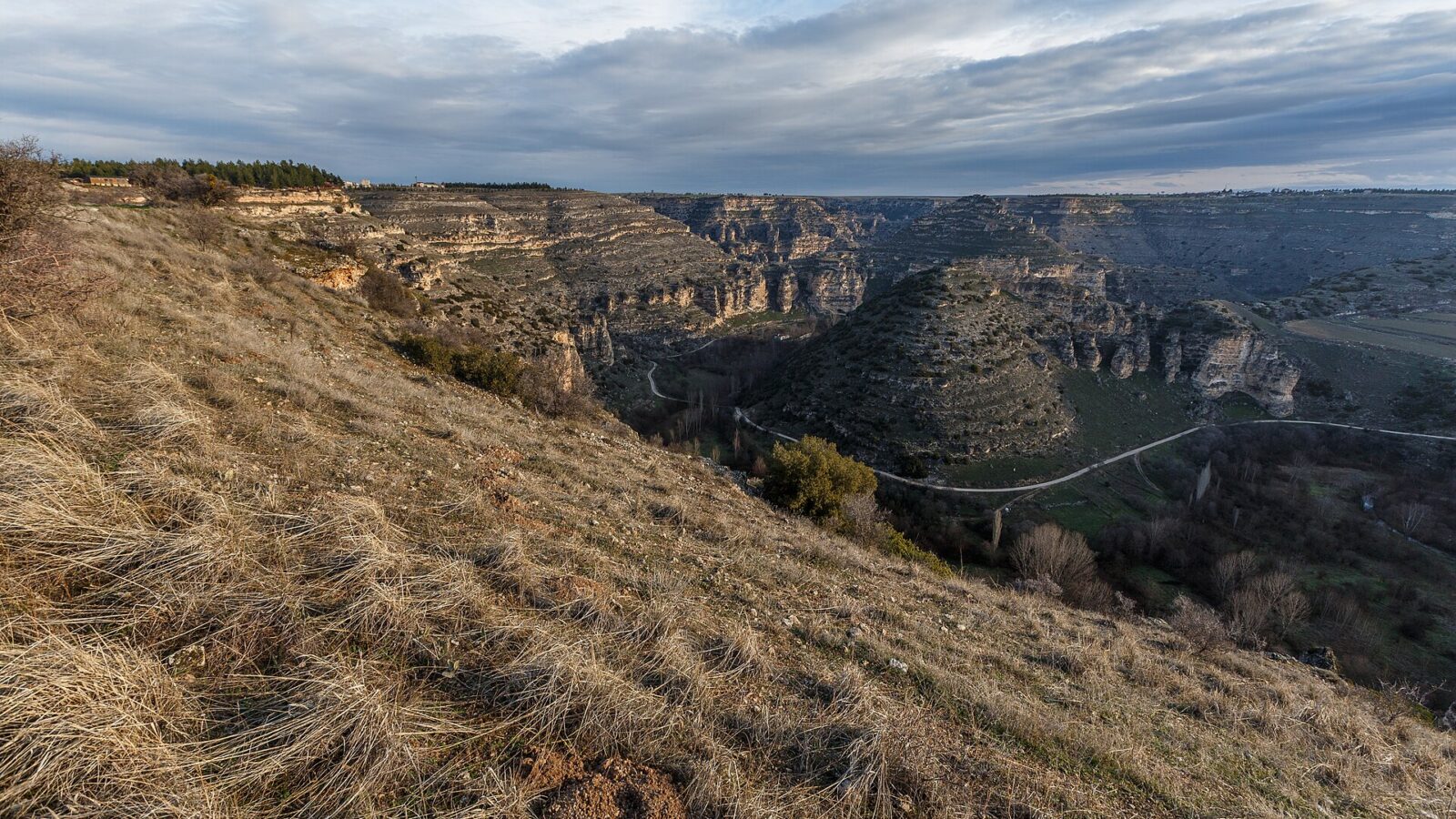
Ulubey Canyon is a system of deep, branching gorges in the south of Uşak province, carved into the plateau by the Banaz and Kazancı streams. Seen from above it looks like a crack in the farmland: the fields run right up to the edge, and then the ground drops away into a winding valley 135 to 170 m deep.
The canyons were declared a nature park in August 2013, and in 2015 a glass-floored viewing terrace shaped like a ship’s bow was built out over the edge, 131 m above the valley floor. It has become the province’s best-known sight.
Estimates of the canyon’s length vary with how many side branches are counted: around 40 to 45 km for the main system, while the provincial culture directorate gives 75 km in total. Either way it is one of the longest canyon systems in Türkiye.
The provincial culture directorate places the canyons east of the Uşak–Karahallı road and treats them, together with the ancient city of Blaundos, as a single attraction. Its planning notes stress that any facilities on the ridges should not disturb the natural structure of the canyon.
How do you get to Ulubey Canyon?
The town of Ulubey is about 30 km southwest of Uşak city. The nature park lies along the Uşak–Karahallı road, about 1 km north of Ulubey town, and the glass terrace is on the canyon edge close to the road. A car is the easiest way to get around: with one you can combine the terrace, the Ulubey pine grove and Blaundos in a day.
Tours in Anatolia
−5% Istambul readers save 5% on every tour below — applied at checkout.
Partner listings via GetYourGuide · free cancellation on most
When is the best time to visit Ulubey Canyon?
Spring (April–June) and autumn (September–October) are best. In spring the valley floor is green and the streams are running; in autumn the light is softer and the air clear for photographs from the terrace. Summer days are hot and there is little shade in the canyon. Late afternoon gives the best light on the canyon walls. In winter snow can dust the rim; the terrace is spectacular then, but paths into the canyon are slippery.
What is the history of Ulubey Canyon?
People have lived on the rim of these canyons since antiquity. The Hellenistic and Roman city of Blaundos was built on a spur almost surrounded by canyon walls, and rock-cut tombs in the cliffs belong to its cemeteries.
Ulubey, the town on the canyon edge, was called Ulu Göbek and took its present name in the Republican period. It became a sub-district in 1851 and a district in 1953. In 1969 the municipality laid out a pine grove of about 80,000 m² on the canyon edge, 500 m before the town entrance, with stairs down to the valley floor.
The 2002 tourism inventory already recommended the Ulubey canyon, together with Murat Dağı, for trekking. The canyon became a nature park in August 2013, and the glass terrace with its café opened in 2015 (see Ulubey Canyon).
What is Ulubey Canyon famous for?
- The glass terrace projecting over a 131 m drop.
- Its scale: one of the longest canyon systems in Türkiye, with walls up to 170 m high.
- Blaundos, an ancient city perched above the canyon.
- The Ulubey Canyon Culture and Tourism Festival and the canyon extreme-sports festival, both on the provincial events calendar.
What can you do at Ulubey Canyon?
Walk out on the glass terrace. The deck has a café and views along one of the main branches of the canyon.
Go down into the canyon. From the Ulubey pine grove, the municipal picnic area on the canyon edge just before the town entrance, a stairway leads down to the valley floor. Walking along the stream gives a very different view of the cliffs from the one on the terrace. Take water and sturdy shoes, and avoid the valley floor after heavy rain.
Visit Blaundos. The ruins sit on a promontory above the canyon at Sülümenli village; the provincial directorate treats the canyon and the ancient city as a single attraction.
Photograph the canyon. The 2002 inventory lists the Kazancı stream and the Banaz stream among the best places in the province for photo safaris.
Follow the Banaz stream. The same stream that cut the canyon flows on through Karahallı district, where the ancient Cılandıras Bridge spans it with a single stone arch 24 m across. The bridge, the terrace and Blaundos together make a full day from Uşak.
Ride or hike. The provincial directorate has promoted horse trekking and village tourism in the canyon area; ask locally what is running.



Frequently asked questions about Ulubey Canyon
How deep is Ulubey Canyon?
Between about 135 and 170 m. The glass terrace stands 131 m above the canyon floor.
How long is Ulubey Canyon?
Around 40–45 km for the main canyon; the provincial culture directorate gives 75 km including the side branches.
How far is Ulubey Canyon from Uşak?
About 30 km southwest of Uşak city. The nature park is about 1 km north of Ulubey town on the Uşak–Karahallı road.
Can you walk in Ulubey Canyon?
Yes. A stairway from the Ulubey pine grove leads down to the valley floor, where you can walk along the stream.
When did the glass terrace open?
In 2015, two years after the canyon was declared a nature park.
What do the official records say about Ulubey Canyon?
The Ulubey district canyon and Murat Dağı, with their natural beauty and clean air, are very suitable for trekking. Murat Dağı has natural areas suitable for cycling tours, and the rich natural potential of the mountain can also be used for horse trekking.
For photo safaris the inventory recommends the Kazancı stream and the Banaz stream; for botanical tourism, Murat Dağı. (Ministry of Culture and Tourism, Uşak Provincial Tourism Inventory, 2002)
Main photo: Cems77, CC BY-SA 4.0, via Wikimedia Commons.
Ready to see Ulubey Canyon?
Hand-picked tours with good reviews and clear prices.
Partner listings via GetYourGuide · free cancellation on most
Before or after: Istanbul
Most trips start or end in Istanbul. Our own experiences there:

 Dinner, sunset and day cruises between Europe and Asia.See cruises bosporuscruise.com
 Historic Turkish baths in the old city — hand-picked hamams, booked direct.Book a hamam istanbulhamam.com

 Istanbul’s tallest viewpoint: both continents from 369 metres.Get tickets camlicatower.com

 Free audio guides in 15 languages, safe routes and local tips — plus 5% off GetYourGuide.Open the free guide localada.com
Nearby
All destinationsBlaundos
Blaundos ancient city near Ulubey, Uşak: a Hellenistic and Roman…
Uşak Archaeology Museum
Uşak Archaeology Museum and the Karun Treasure: Lydian gold looted…
Uşak
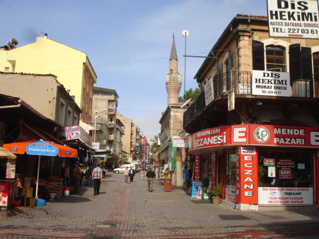
Uşak travel guide: the Karun Treasure of Lydian gold, Ulubey…

Kocaeli
Kocaeli and its centre İzmit, ancient Nicomedia: once an eastern…